mattonthesea
Well-Known Member
I've posted this on CA site but thought maybe more hive mind here ?
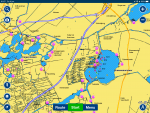
Just out of interest really. On my ENC charts, my VMH charts, the Dutch waterways downloadable charts and the CA Almanac; BETWEEN GOUDA AND HARLEM the Standing Mast Route loses all but base level data. IE the water is just not there, or it's an inaccurate blue line. We've got around it with a combination of Captain's mate and the Dutch app but it does seem weird.
Any explanation? Copyright?
Edit; missed an important bit of info!
Last edited:

