thefatlady
Well-known member
Before I bin them, is anyone interested in old (like 25 years) paper charts?
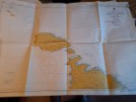
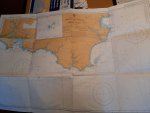
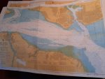
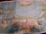
I haven’t checked every one, but all believed to be in excellent condition and uncorrected except where noted. If anyone wants them, I’ll check. A few sample photos below.
Start Point – Lizard Point (Imray C6)
English Channel Western Section (Stanfords 2)
English Channel Central (Stanfords 7) - pencil marks
English Channel, Goodwins to Selsey Bill (Stanfords 9)
Langstone and Chichester Harbours (Imray Y33)
Portsmouth Harbour (Admiralty 2631)
The Solent, Eastern Part (Admiralty 394) - Pencil marks and slight crease damage
The Solent, Western Part (Admiralty 2040) - Pencil marks and slight crease damage
The Solent, Bembridge to Hurst Point & Southampton (Imray C15)
Harbours and anchorages in the west Solent area (Admiralty 2021)
Isle of Wight (Imray C3) – very tatty.
Poole Harbour and approaches (Admiralty 2611) - slight crease damage
Needles Channel to Bill of Portland (Imray C4)
Portland Bill to Start Point (Imray C5)
Eddystone Rocks to Berry Head (Admiralty 1613) - slight staining on reverse and slight crease damage
Falmouth Harbour and River Fal (Imray Y58)
The Channel Islands (Stanfords 16)
North Brittany Coast (Stanfords 17)
Baie de Seine, Le Havre to Cherbourg (Imray C32)
Banyuls – Port Leucate (Navicarte 511)
Majorque Est – Minorque (Navicarte E.01)
Majorque Ouest Ibiza – Formentera (Navicarte E.02)
Banyuls – El Estartit (Navicarte E.03)
El Estartit – Tossa (Navicarte E.04)
Tossa – Barcelona (Navicarte E.05)
Gozo, Comino, Northern part of Malta (Admiralty 2537)
Malta (Admiralty 2538)


